Wharram Percy deserted medieval village
Listed on the National Heritage List for England. Search over 400,000 listed places
Overview
- Heritage Category:
- Scheduled Monument
- List Entry Number:
- 1011377
- Date first listed:
- 09-Oct-1981
Location
Location of this list entry and nearby places that are also listed. Use our map search to find more listed places.
Use of this mapping is subject to terms and conditions.
This map is for quick reference purposes only and may not be to scale.
What is the National Heritage List for England?

The National Heritage List for England is a unique register of our country's most significant historic buildings and sites. The places on the list are protected by law and most are not open to the public.
The list includes:
🏠 Buildings
🏰 Scheduled monuments
🌳 Parks and gardens
⚔️ Battlefields
⚓ Shipwrecks
Historic England Archive
Search over 1 million photographs and drawings from the 1850s to the present day using our images archive.
Find PhotosOfficial list entry
- Heritage Category:
- Scheduled Monument
- List Entry Number:
- 1011377
- Date first listed:
- 09-Oct-1981
- Date of most recent amendment:
- 08-Oct-1993
Location
The building or site itself may lie within the boundary of more than one authority.
- District:
- North Yorkshire (Unitary Authority)
- Parish:
- Wharram
- National Grid Reference:
- SE 85816 64348
Reasons for Designation
The village, comprising a small group of houses, gardens, yards, streets,
paddocks, often with a green, a manor and a church, and with a community
devoted primarily to agriculture, was a significant component of the rural
landscape in most areas of medieval England, much as it is today. Villages
provided some services to the local community and acted as the main focal
point of ecclesiastical, and often of manorial, administration within each
parish. Although the sites of many of these villages have been occupied
continuously down to the present day, many others declined in size or were
abandoned throughout the medieval and post-medieval periods, particularly
during the 14th and 15th centuries. As a result over 2000 deserted medieval
villages are recorded nationally. The reasons for desertion were varied but
often reflected declining economic viability, changes in land use such as
enclosure or emparkment, or population fluctuations as a result of widespread
epidemics such as the Black Death. As a consequence of their abandonment
these villages are frequently undisturbed by later occupation and contain
well-preserved archaeological deposits. Because they are a common and
long-lived monument type in most parts of England, they provide important
information on the diversity of medieval settlement patterns and farming
economy between the regions and through time.
Wharram Percy is of exceptional importance not only because of the excellent
state of preservation of its remains but because of the depth and breadth of
study that has gone into interpreting the site as entirely as is possible
using current techniques. Few other monuments have provided such a large
corpus of data yet the majority of the site is still undisturbed. Remains
from all periods of this multi-period settlement site will survive well and in
situ throughout the unexcavated areas.
Details
Wharram Percy, situated on the high chalkland of the Yorkshire Wolds, is one
of the best known and most intensively studied deserted villages in England.
Partial excavations have been carried out there since 1950, with 1990 being
the fortieth and final season of the current programme. In that time evidence
has been recovered of a multi-period settlement site with occupation spanning
more than five thousand years from the Neolithic to the post-medieval period.
The monument comprises a single area which includes the remains of the
medieval village, the parish church of St Martin which is also a Grade II*
Listed Building, the sites of the medieval mill and fishpond and the sites of
two medieval manor houses. Also included are the Iron Age and Romano-British
settlement, the early-middle Saxon vill, the post-medieval farmstead and also
the medieval and post-medieval vicarage. Around the area but not included in
the scheduling are traces of ridge and furrow, the earthwork remains of
medieval ploughing.
The last record of the village dates to 1517 when legal proceedings were taken
against the landlord for the eviction of what may have been the last four
families living there. Clearly the tenants lost their case because, at about
that time, the village was depopulated and given over to pasture with only the
parish church of St Martin continuing in use down to the 20th century. In the
late 14th century, on the eve of this last act of depopulation, the village
consisted of thirty houses laid out in two facing rows, an arrangement typical
of the Yorkshire Wolds. The longer western row comprised about twenty houses
built along the edge of a flat hilltop while the shorter eastern row lay along
the valley floor. The remains of these two rows appear today as the grassed
over foundations of stone-built houses and outbuildings associated at their
rear with banked rectangular enclosures. The enclosures were known as crofts
or garths while the ground on which the buildings stood was called a toft. A
headrow with a manorial complex and additional tofts and crofts lay across the
north end, the whole being a planned village laid out at some point between
the tenth and 12th centuries.
Entering the village from the north is a prominent hollow way which formed the
main road through the village and formerly linked it with the deserted village
of Towthorpe which shared its church. A network of shallower sunken tracks
link up with the hollow way from the west and represent paths through the main
part of the village. On the north side is one which led north-westward to New
Malton, the principal market place for the region. North of this is a separate
complex of earthworks which represents the site of the late 13th century manor
house and its outbuildings. In addition to the lord's accommodation, among its
elements are a circular dovecote, service buildings, a barn and also a garden.
An earlier manor house, dating to before the mid-13th century, has also been
located near the centre of the village remains. This consisted of a stone-
built solar block (the private accommodation of the lord) and one wall of a
timber hall which was partially destroyed by late 13th century quarrying after
the manor site shifted. Features found at the rear of the house include a
hayrick stand, a cold store and a latrine-pit. In the early 14th century the
area was levelled prior to the building of a new peasant houses.
Excavation of some of these houses has indicated that the local chalk was not
used as a building material for peasant dwellings before the 13th century.
Post-holes and beam slots show that, prior to this, houses were timber-built.
The chalk houses of the later Middle Ages were cruck-built longhouses
typically consisting of three bays which included a living area with a central
hearth flanked on one side by a room which may have doubled as both dairy and
sleeping accommodation and, on the other, by a cow-byre divided from the rest
by a cross passage. In cruck buildings the roof is supported independently of
the walls by the timber crucks and excavations have shown that these timber
frames were permanent features while the chalk walls in between were
frequently renewed or rebuilt. Small finds from the peasant houses include
spindlewhorles, sewing implements, gaming boards and pieces, domestic pots,
and metal objects such as keys and hinges. Examples of the latter designed to
hold heavy doors and window shutters also indicate the sturdiness and
permanent nature of the later medieval houses.
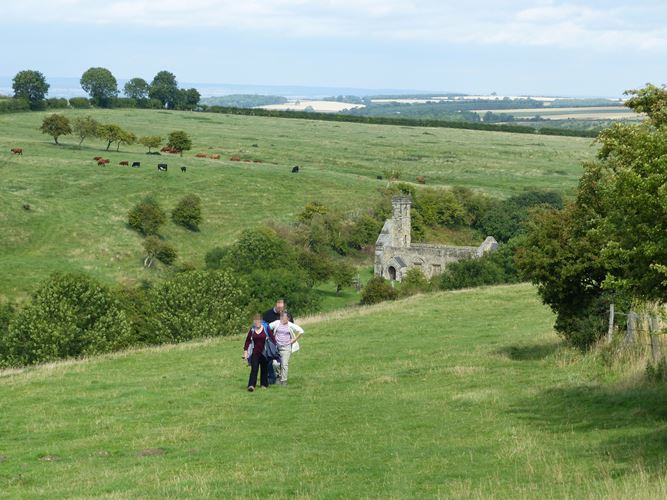
The only surviving medieval building is the parish church of St Martin which
continued in use till 1949 and has been the site of occasional services since.
The earliest documentary reference for the church dates to c.1210 but
excavation has shown that there has been a church on the site since the tenth
century. The first church, which was timber-built, was replaced in the late
tenth or early 11th century by a small two-celled stone church with a
rectangular nave and chancel. This is believed to have been not the parish
church but the private chapel of a late Saxon lord. In the mid-12th century,
when the parish was formed, a larger two-celled church was built which had, in
addition, an apse at the east end. A large west tower was begun but abandoned
because of structural problems and a smaller tower, built unusually half-in
and half-out of the west-end, was added instead. This tower collapsed in 1959.
In the late 12th century a large south aisle with an arcade of Norman arches
was added while, in the 13th century, a north aisle with pointed arches was
also built to accommodate an increasing parish population. The last addition,
the north-east chapel, dates to the early 14th century. After that the church
began to decline, the south aisle first being reduced in length then, in
c.1500, demolished along with the north aisle and the chapel. In the 17th
century, the chancel was also reduced in size.
North of the church is the medieval cemetery of which some 600 burials have
been excavated. This was in use throughout the late Saxon and medieval periods
and will provide important demographic evidence. East of the church, in the
valley bottom, is the stream which provided the village with its water.
Excavations carried out south of the church showed that, from the late Saxon
period a complex sequence of low clay dams had been built to create a millpond
for a horizontal water mill which survived in use till the 13th century when
it became derelict. The dam was then heightened and milling continued. Prior
to the mid-13th century, when there were two manors, there were also two
mills, one to the north of the village and one to the south. The site of the
northernmost has not yet been found though a 13th century grain-drying
kiln was located in the north manorial complex and it is known that, in the
14th century, it was this mill that continued in use after the southern
millpond was converted to a fishpond and a larger rubble dam constructed in
place of the earlier dams. The fishpond was restored in the 18th century and,
in the 19th century, a sheep-wash was built against the dam.
Evidence for pre medieval occupation was first discovered during the partial
excavation of the hall belonging to the later manor when Iron Age and Romano-
British material was found beneath the south wall. Later, trial trenches, cut
through the medieval village boundaries, demonstrated that the main medieval
earthworks followed earlier Iron age or Romano-British boundaries. These
small scale excavations, in addition to geophysical survey, indicate that a
high status Iron Age settlement consisting of two farms lay north of the
medieval village. A defensive ditch with its entrance was found and also a
ladder system of rectangular enclosures lying on an east-west axis. The
enclosures were modified slightly during the Romano-British period for which
evidence of timber buildings and late Roman grain drying ovens has been found.
The medieval hollow way to New Malton was also found to have been laid out at
this time with the settlement lying on either side.
In all, along with two Roman burials and a late Iron Age/Romano-British
quarry, five farms of the period have been located indicating expansion of the
settlement from the Iron Age to the mid Roman period. It is not yet known
whether these farms were independent or based on a Roman villa which has not
yet been located. The possibility of continuity between the late Roman and
early Saxon periods has been indicated in the discovery of sixth century
material in one of two sunken floored buildings found cut into the Iron Age
road. The postholes of a Saxon timber building of uncertain date were also
found north of this road and also two further sunken floored buildings dated
to the eighth century. A major Saxon site was found beneath the first
medieval manor where a Saxon midden preserved Middle Saxon pottery, a smith's
workshop containing large amounts of slag, and more postholes. The evidence
so far indicates at least six areas of Saxon occupation, five of which were of
high status with evidence for metalworking, coins and imported pottery. They
suggest a spaced group of independent farms dating from the mid seventh
century to the ninth. There is also evidence of continued occupation into the
tenth century at the time of Scandinavian settlement.
The lack of 14th century pottery at the later medieval manor house, in
addition to documentary evidence detailing the deterioration of the manorial
buildings by the mid 14th century, suggests that the lord was no longer
resident at this time and that the services owed to him by his tenants had
been commuted to rents. Although the process is not fully documented, it seems
likely that the gradually declining population over the latter half of the
century, and the corresponding loss of revenue, would have been the cause of
the final eviction of the tenants and the subsequent giving over of the land
to pasture. This pasture, and the sheep flocks that grazed it, were managed
from a single farm located in the valley north of the church. The 16th and
earlier 17th century farmhouse has not been excavated though its location at
the southern end of the east row of village houses is known. It is partially
overlain by the late 17th century farm which was itself rebuilt on a slightly
different alignment by Sir Charles Buck between 1775 and 1779. The later farm
comprised a substantial seven roomed house faced with brick and a courtyard of
outbuildings to the north. The south range of the complex survives to the
present day as a line of cottages. By 1851 this farm had been demolished, its
role taken over by the present day Wharram Percy Farm.
Also near the church are the remains of the vicarage. The postholes of a large
timber building believed to be the late Saxon or early medieval vicarage
have been found north of the churchyard boundary. In the 12th or 13th century,
however, the churchyard was expanded and the vicarage was moved, possibly to
the south side of the churchyard where rubble from a building demolished in
the early 14th century has been found in the south east corner and is of
better quality than the material of the contemporary peasant houses. The
succeeding late medieval vicarage was a larger building built north of the
church, partly overlying the old churchyard. Little is yet known about this
building since excavation was only recently carried out. Two buildings have
been identified: the cruck barn known to have burnt down in the 16th century
and a 16th century rebuild of an earlier kitchen. After the fire, the vicarage
of the 16th and 17th centuries was built to the east and included among its
buildings a stone-built cold cellar. In the 18th century a new parsonage was
built still further east but had been demolished by the mid-19th century.
There are a number of features which are excluded from the scheduling. These
include all fixtures such as interpretation boards, all modern fencing and
gates, the telegraph poles crossing the site and the labourers' cottages but
the ground beneath all these features is included. The church and
remains of Wharram Percy have been in State care since 1972 and 1974
respectively.
MAP EXTRACT
The site of the monument is shown on the attached map extract.
Legacy
The contents of this record have been generated from a legacy data system.
- Legacy System number:
- 13302
- Legacy System:
- RSM
Sources
Books and journals
Beresford, M, Hurst, J, Wharram Percy Deserted Medieval Village, (1990)
'Annual Reports of the (Deserted) Medieval Village Research Group' in Annual Reports of the (Deserted) Medieval Village Research Group, (1954)
Other
Annual Reports of the Medieval Settlement Research Group, 1986, in progress
Legal
This monument is scheduled under the Ancient Monuments and Archaeological Areas Act 1979 as amended as it appears to the Secretary of State to be of national importance. This entry is a copy, the original is held by the Department for Culture, Media and Sport.

Map
This map is for quick reference purposes only and may not be to scale. This copy shows the entry on 21-Apr-2025 at 13:06:44.
Download a full scale map (PDF)© Crown copyright [and database rights] 2025. OS AC0000815036. All rights reserved. Ordnance Survey Licence number 100024900.© British Crown and SeaZone Solutions Limited 2025. All rights reserved. Licence number 102006.006.
End of official list entry


