Overview
- Heritage Category:
- Park and Garden
- Grade:
- II
- List Entry Number:
- 1001301
- Date first listed:
- 22-Sep-1994
Location
Location of this list entry and nearby places that are also listed. Use our map search to find more listed places.
Use of this mapping is subject to terms and conditions.
This map is for quick reference purposes only and may not be to scale.
What is the National Heritage List for England?

The National Heritage List for England is a unique register of our country's most significant historic buildings and sites. The places on the list are protected by law and most are not open to the public.
The list includes:
🏠 Buildings
🏰 Scheduled monuments
🌳 Parks and gardens
⚔️ Battlefields
⚓ Shipwrecks
Historic England Archive
Search over 1 million photographs and drawings from the 1850s to the present day using our images archive.
Find PhotosAlso of interest

Official list entry
- Heritage Category:
- Park and Garden
- Grade:
- II
- List Entry Number:
- 1001301
- Date first listed:
- 22-Sep-1994
The scope of legal protection for listed buildings
This list entry identifies a Park and/or Garden which is registered because of its special historic interest.
The scope of legal protection for listed buildings
This list entry identifies a Park and/or Garden which is registered because of its special historic interest.
Location
The building or site itself may lie within the boundary of more than one authority.
- District:
- Sandwell (Metropolitan Authority)
- Parish:
- Non Civil Parish
- National Grid Reference:
- SP 01216 86022
Details
A landscape park laid out according to the designs of Humphry Repton, who produced a Red Book for the site in 1795.
HISTORIC DEVELOPMENT
In the early 1790s, Samuel Galton, who had recently purchased the estate, called in Humphry Repton to draw up plans to convert the existing system of fields into a fitting setting for a new house. The house was completed by Galton's son, Hughbert, in 1819. In 1902, the site was purchased by the City of Birmingham, and remains (1999) in use as a public open space.
DESCRIPTION
LOCATION, AREA, BOUNDARIES, LANDFORM, SETTING
Warley Park (40ha) lies 5km west of the centre of Birmingham, 100m north of the A456 from Halesowen to Birmingham. It occupies the west and east sides of a small valley, now enveloped by housing.
The western boundary of the site is marked by Harborne Road, the line of which takes that recommended by Repton, running to the west of its earlier route in order to bring an existing tower, Warley Tor, into the park. The Tor has since been demolished.
Barclay Road forms the eastern boundary, beyond which is early C20 housing. This is the extent of the park as suggested by Repton, the land between the park edge and what is now known as the Wigorn Road, being divided into two large fields, Lower Gold Field and Upper Gold Field.
An additional area has been incorporated into the park since Repton's time, completing the south-west corner, but the original boundaries of the park can still be clearly traced. This land forms part of a golf course.
ENTRANCE AND APPROACHES
The main entrance to the park is off Abbey Road, the public road which forms the northern boundary of the site. From here, the drive sweeps up to the east of the house site, and continues to join with the entrance from the south, off Lightwoods Hill. Neither of the two entrance lodges formerly present survive.
PRINCIPAL BUILDING
The house built after 1790 was demolished in 1957. It stood towards the top of the western slope of the valley. The entrance front was to the east side, rather than the west as advocated by Repton.
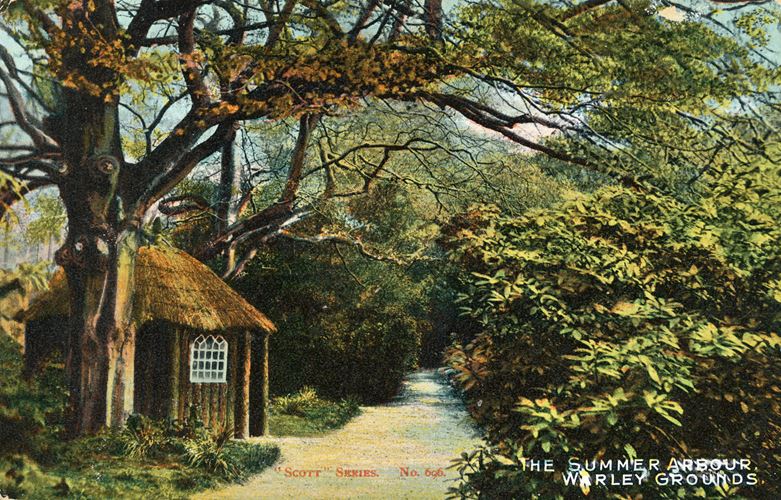
GARDENS AND PLEASURE GROUNDS
In accordance with Repton's proposals, a 'winter garden', traces of which survive, was laid out adjacent to the house to the south.
PARK
The main expanse of the park lies to the east of the house site and still shows the remnants of the plantation as put forward in the Red Book. This was a simple scheme, with a couple of major clumps and a scattering of specimen trees. The planting along the eastern boundary has been strengthened since the development of the land beyond.
A small stream ran through the valley which was used to form a small pool by the northern entrance. This has now been filled in, but its outline remains visible in the grass.
Repton incorporated into his design an existing woodland, the Great Copse, which occupied the south-east corner of the site. He improved its outline, cutting it through with walks, and adding a Classical temple from which there were views back to the house. Although the eastern end of this wood has been lost to housing and the temple has been removed, the western part survives.
Humphry Repton (1752-1818), who first visited Warley in 1794, presented his Red Book for the site in March 1795, prior to the publication of his Sketches and Hints on Landscape Gardening. It was unusual as a commission for Repton, in that he was asked to lay out a 'new' landscape, rather than improve an existing one, and the ground was still divided into fields when he arrived. His recommendations included the extent and choice of the style of design (park rather than ferme ornée), the siting of the house, plantations, approaches, walks and rides, a pond formed from the stream through the valley bottom, and a temple. His proposals were largely carried out.
KITCHEN GARDEN
The remains of the kitchen garden stand to the west of the house site. It was sited here against Repton's judgement; he recommended that it be kept at a greater distance from the residence.
REFERENCES
G Carter et al, Humphrey Repton, Landscape Gardener 1752-1818 (1982), p 164
Archival items
H Repton, Red Book, 1795 (Sandwell District Library)
Description written: February 1999
Register Inspector: PAS
Edited: October 1999
Legacy
The contents of this record have been generated from a legacy data system.
- Legacy System number:
- 2333
- Legacy System:
- Parks and Gardens
Legal
This garden or other land is registered under the Historic Buildings and Ancient Monuments Act 1953 within the Register of Historic Parks and Gardens by Historic England for its special historic interest.

Map
This map is for quick reference purposes only and may not be to scale. This copy shows the entry on 14-May-2025 at 17:06:13.
Download a full scale map (PDF)© Crown copyright [and database rights] 2025. OS AC0000815036. All rights reserved. Ordnance Survey Licence number 100024900.© British Crown and SeaZone Solutions Limited 2025. All rights reserved. Licence number 102006.006.
End of official list entry


